
Scientific Components of OARRA’s
Monitoring/Survey Program
The Survey Area
The area that OARRA monitors and surveys lie within the Southern California Bight. This 426 mile (685 km) Bight consists of the coastline stretching from Point Conception in Santa Barbara County to Punta Colonet in Mexico. Included in the Bight is the area of the Pacific Ocean defined by the curve, including the Channel Islands of California and the Coronado Islands, and Islas de Todo Santos of Baja California. Not only is the Bight heavily populated and traversed by numerous species of marine mammals and sea turtles, but the Bight coastal zone is also home to more than 22 million people who engage in a wide variety of industrial, military, and recreational activities. This zone contains nearly 6,000 square miles of the watershed area draining into the waters. The Southern California Bight is a lengthy stretch of waters that have long been vulnerable to the impacts of human activities.
Presently, the focus area that OARRA is actively conducting surveys and monitoring trips is the 112 miles of coastline, which makes up Los Angeles and Orange County Coastline. This area affords a variety of microhabitats to study, from the busy Ports of Long Beach and Los Angeles to the relatively more rural habitat of the San Mateo Rocks off the shore of San Clemente. The animals that OARRA is surveying and monitoring are freely moving about the marine environment both locally and internationally; OARRA is collaborating with professional organizations in both neighboring southern California counties and the international waters of Mexico to mirror this program in these areas.

This map shows a small example of the visible human influence within the Southern California Bight.
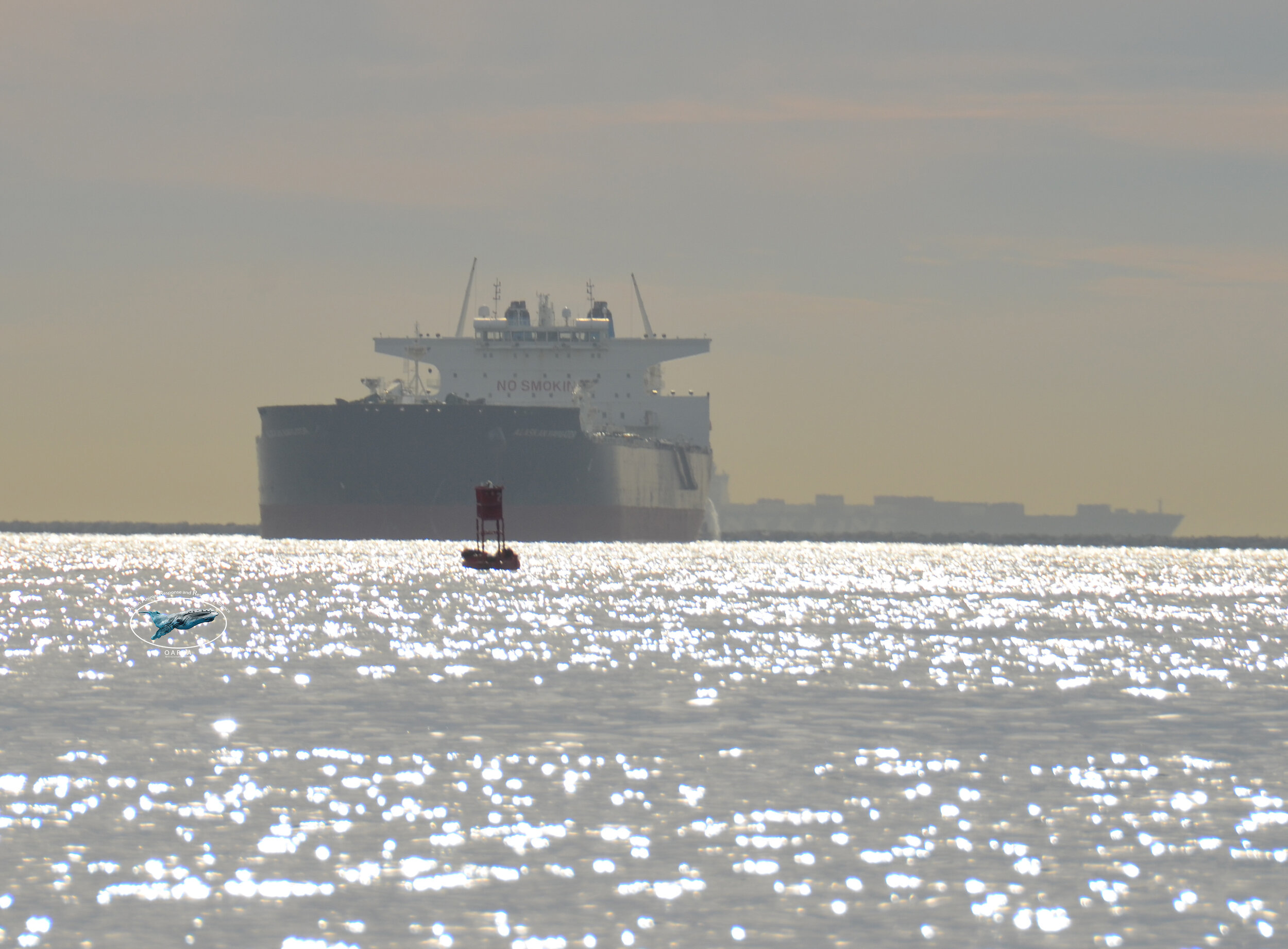
Sea lions, resting on a buoy, amongst the busy waters of the Port of Los Angeles, California.

Aerial view of marine animals hauled out on San Mateo Rocks, San Clemente, California.
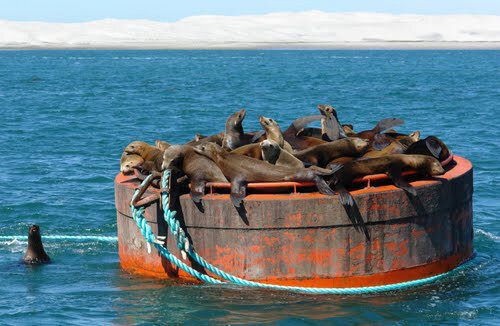
Sea lions congregating on a mooring buoy in an unidentified lagoon of Mexico.
HOW?

Determination of Health and Population Index
The data that OARRA collects, through the continuous observation of the health and population index of the marine animals detected on its’ monitoring and survey trips, is vital to assisting scientists in:
Detecting changes to the health status,
Population dynamics,
Determining seasonal shifts in the population of the marine animals in the study area,
Establishing a baseline for understanding health, nutritional status, and causes of mortality
During OARRA’s Monitoring trips, along with environmental conditions, each marine animal, when possible, observed and recorded is classified in the following ways:
Age Class:
Pup <1 yr
Yearling > 1 yr - <2 yrs
Sub Adult Male
Sub Adult Female
Adult Male
Adult Female
Unknown
Body Condition Index:
Condition 1 (Emaciated)
Condition 2 (Thin)
Condition 3 (No ribs showing)
Condition 4 (No ribs or pelvis showing)
Condition 5 (Fat)
Signs of Human Interaction
Entangled
Fishing Interaction - hooks
Propeller cut
Signs of Injury other than human interaction
Shark Bite
Other

Three California sea lions hauled out on a dock. The adult male (center) Body Condition Index (BCI) 5, sub-adult male (left) BCI 4, adult female (right) BCI 3.

Two adult female sea lions (left) both showing their BCI of 4. A Yearling sealion (right) showing a BCI of 2.

One Adult male and two juvenile sea lions hauled out on a buoy, Dana Point CA. All have a Body Condition Index (BCI) of 3-4

An adult female sea lion entangled in monofilament line or netting. Though still in good body condition (BCI 3+), the entanglement, if not removed, could prove fatal for this animal.

W5713, with signs of fisheries interaction, the three-pronged hook, in her jaw (yellow arrow). Here hauled out on a buoy outside of LA harbor 14 days after release from rehab.

Close-up of hook and line(red arrows) in W5713 left lip/chin
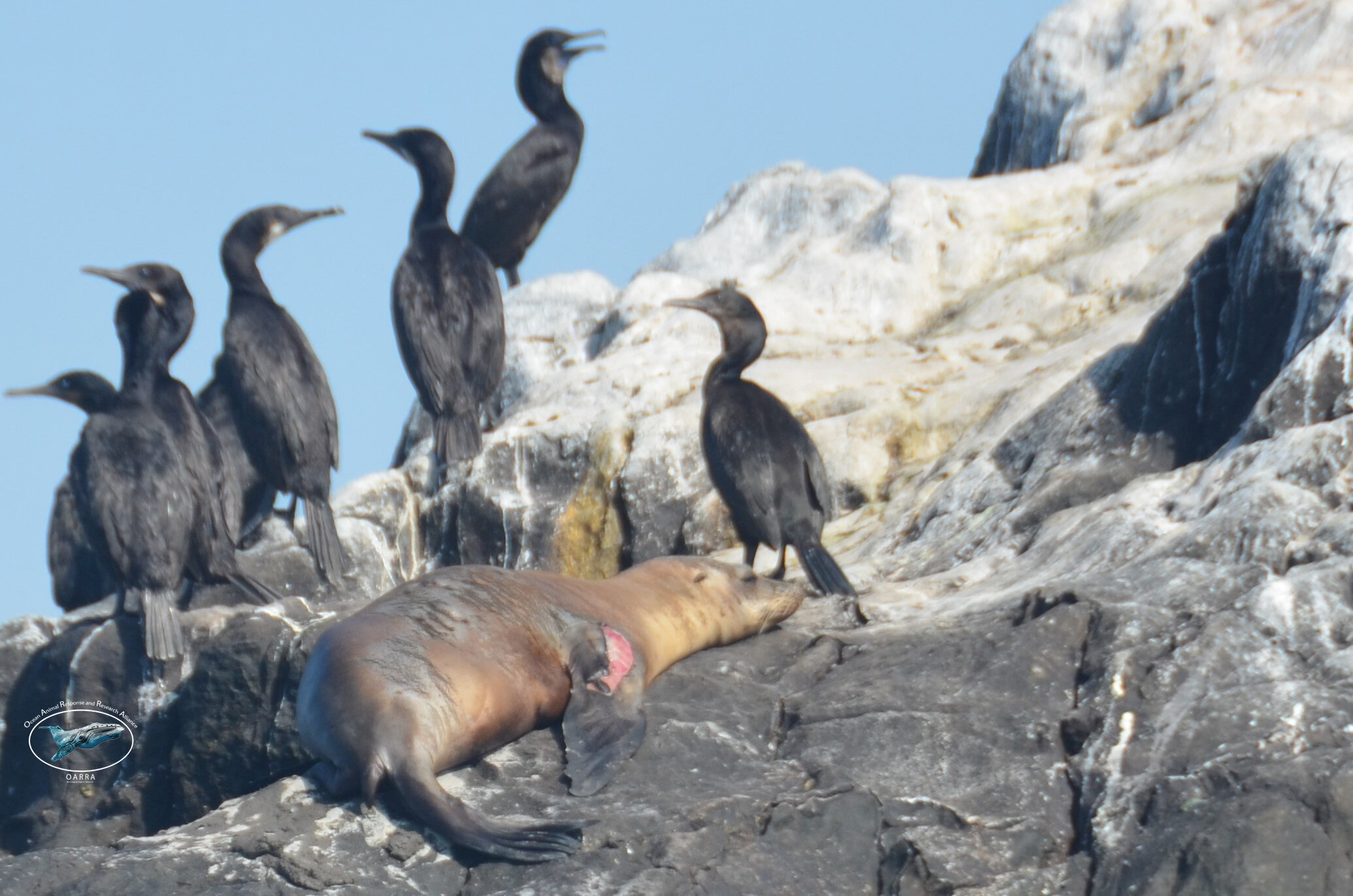
August 12, 2021, A juvenile sea lion OARRA observed with an injury to its left shoulder.
Human Pressures and Environmental Factors
Marine animals have shown their supreme adaptability to human-induced pressures on the shared marine environment, but how has this affected their health status? The marine environment they have adapted to, and we share, is filled with both visible and invisible threats, from the safe navigation amongst the marine traffic to swimming and feeding in the area of the biggest DDT dumping grounds; the threats are seemingly overwhelming. Yet, all adapt, but at what cost?
OARRA, during its Monitoring and Survey trips, will document both negative and positive human influences and natural environmental factors. With the collaboration of the Alliance and other interested parties, this information added to the additional information gathered on the trips, we will begin to understand the overall effect these influences have on the marine environment and its inhabitants, including us.

A common dolphin (Delphinus d.) recorded swimming amongst the floating trash deep inside the Port of Los Angeles.

Sea lions hauled out in the Port of Los Angeles, adapting to living in the busiest port in the western hemisphere.

A typical day of vessel traffic in and around the Ports of LA and Long Beach.
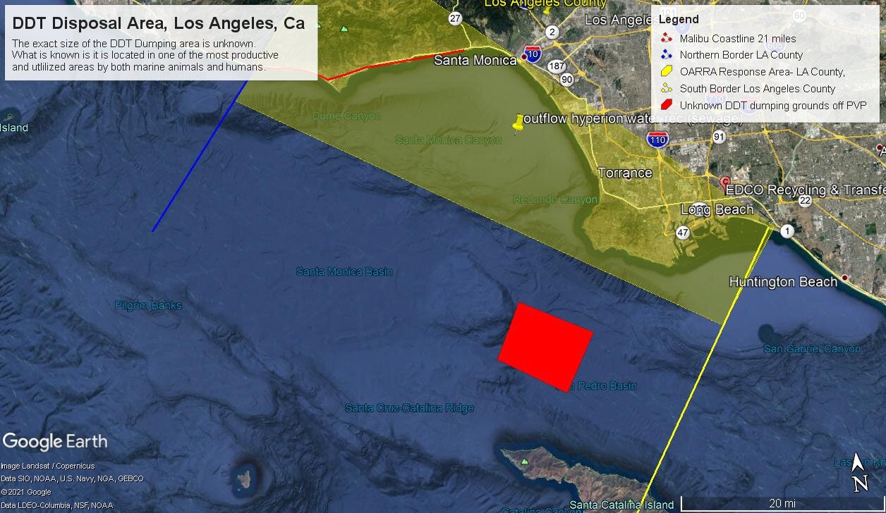
Just a few of the threats to the environment, marine animals and humans on the coastline of Los Angeles County, CA.
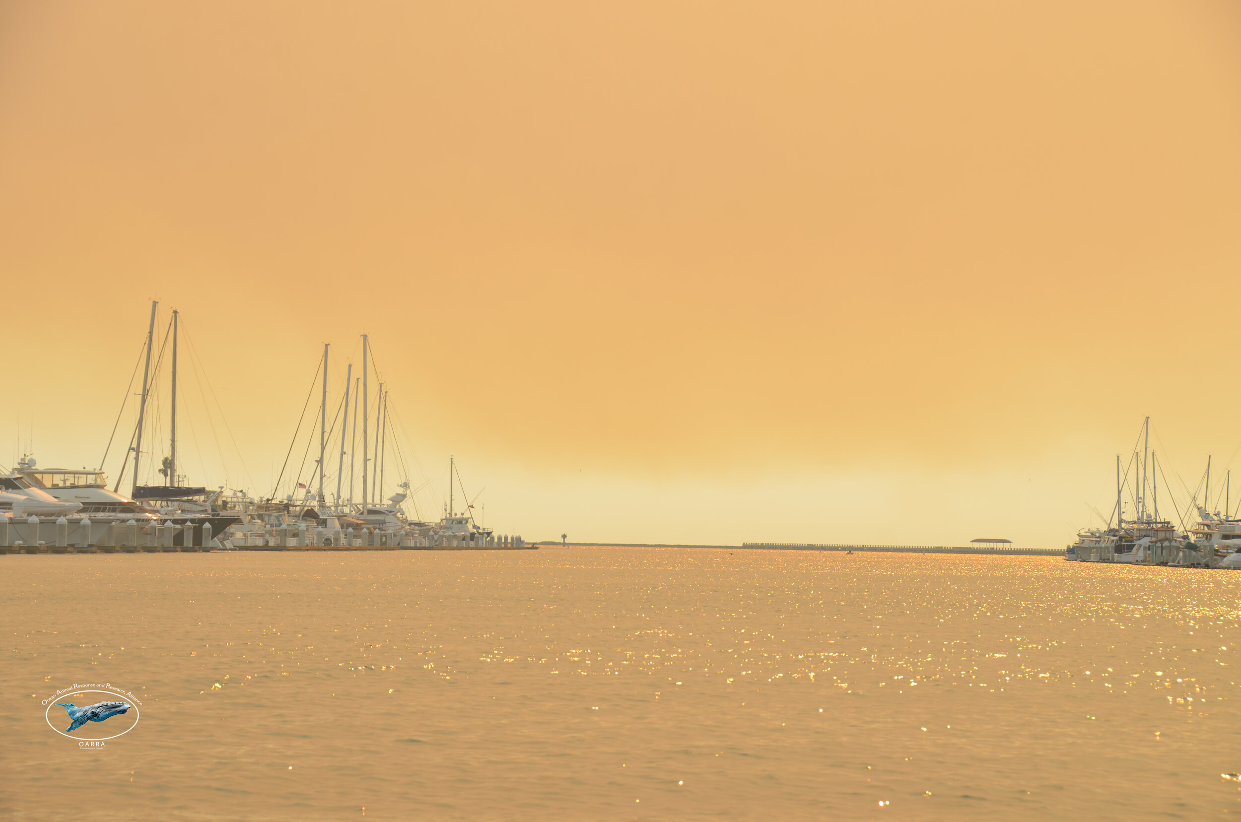
Smoke from the CA wildfire blankets the LA harbor adding another stressor to the marine environment and its inhabitants.

Sea-Bird with Flip Top.

CA sea lions hauled out on the rudder of a large cargo ship in the LA Harbor.

Resite of Tagged or Marked Pinnipeds
An estimated 14,000 marine animals have been flipper tagged and released into the wild after their successful rehabilitation. The ease to observe, resite, and identify individuals while documenting their health and movement within the entire Southern California bight is unique to this coastline. OARRA, through the reporting of flipper tags, can utilize data from the national stranding database, determine the following:
Assess the survival of these animals after release
Estimated the age at the time of resite
Estimated time passage since being tagged
Location of the animal
Body condition
Habitat usage and utilization
Assist in evaluating the efficiency of the rescue and rehabilitation efforts

W5866 hauled out and sunning, July 15, 2021, on floating dock inside LA Harbor 2.62 yrs post-release from rehabilitation for malnutrition. He is estimated to be 5 yrs old with a BCI of 4+.
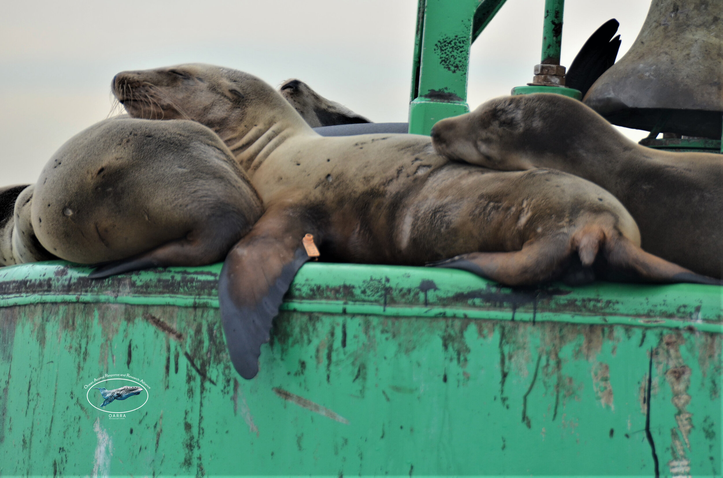
November 5, 2020, W2115 alive, hauled out on a buoy, Port of Los Angeles. He has a BIC of 3 and is estimated to be 2.4 yrs old.

March 8, 2021, W2115 was found deceased from a possible shark bite to his abdomen.
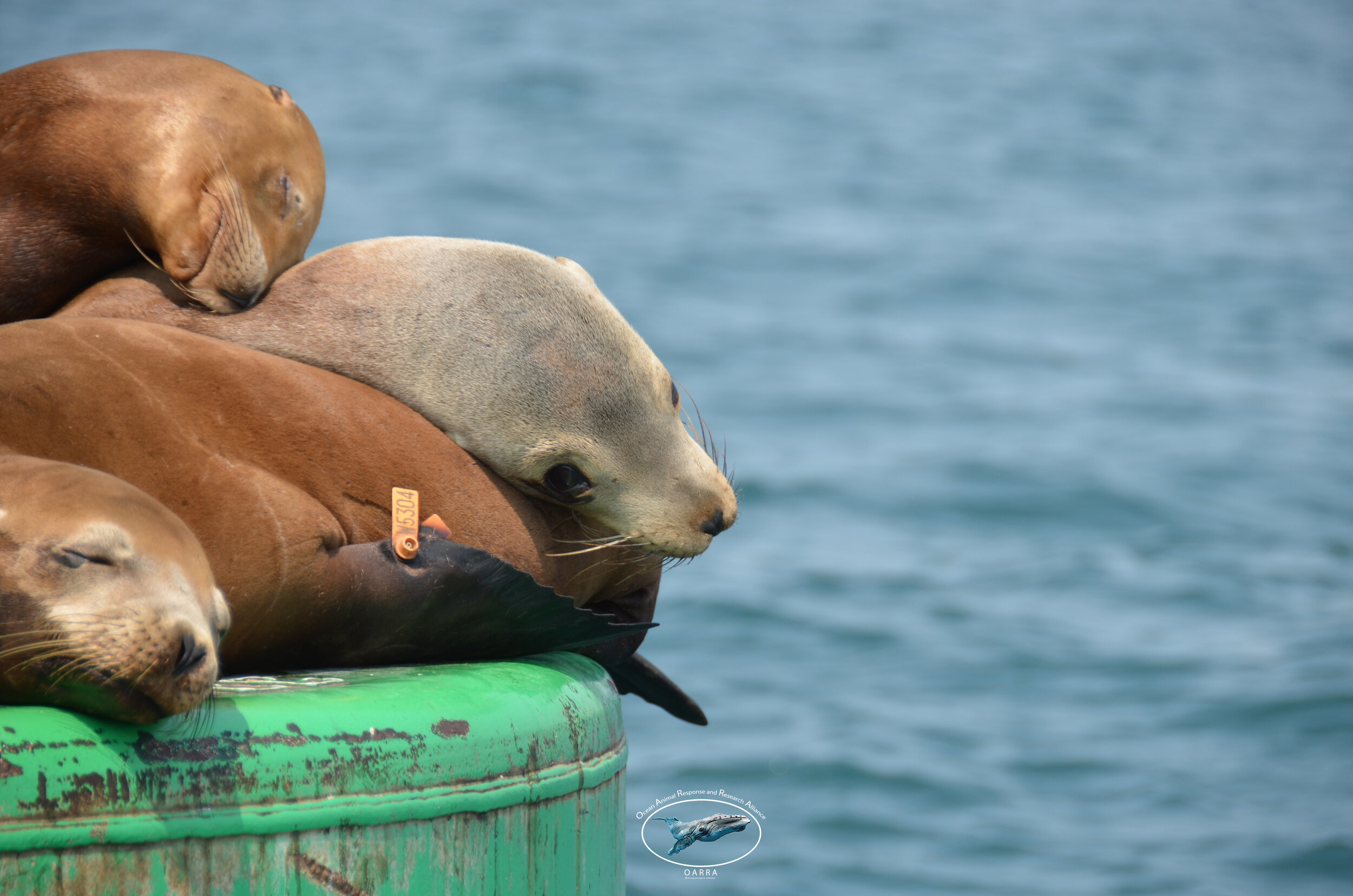
W5304 resited August 20, 2020. Above, He is 1 yr post-release from rehabilitation for malnutrition. He is estimated to be 2.18 yrs old and his body condition index is 3+.

OARRA is performing consistent monitoring/survey trips on the southern California coastline and, working with our alliance members and citizens of science, is building a database of these unique individuals. We have successfully tracked individuals from the LA harbor to La Jolla to the lagoons of Mexico; other individuals maintain a home base within Orange county. Others have been sited once, never to be seen again. Where did they go? Only further study and collaboration over time will tell.
OARRA has already started with this program. Will you join the effort to help understand?

Example Summary of Data
The results above are from observations and the classification of the animals on this page. Results show approximately 80% of the animals are of good body condition with an average BCI of 3-4. Forty percent of the animals are juveniles (>1-4), and <10% of animals show injury or entanglement. These results could indicate that marine mammals in this area appear healthy, and OARRA and other stranding organizations could plan for low-normal marine mammal strandings and mortality responses for the immediate future.

Why?
Through the development of essential baseline data, OARRA, along with scientists and managers, will be able to detect trends, both negative and positive, within the marine animal population utilizing our shared marine environment. This early detection will have substantial positive repercussions in both being proactive and prepared for negative trends. For example, if all animals are body codes 3-4, as shown above, and suddenly this shifts to 1 or 2, we will know and can prepare for a higher number of live and dead strandings. Conversely, if the body condition code stays at codes 3-5, both live and dead strandings should be normal to low. We should also see trends in the diversity of age classes throughout the year, with large adult males having a higher presence in the study area during the winter months. Pups and yearlings should be seen in higher numbers during the summer months.
Through consistent trips and data collection, we will begin to understand the ebb and flows of the health and welfare of these canaries of the sea, the marine animals.
Help us turn the negative trends positive through action.

